


South Central Iowa PUMA, Iowa
About
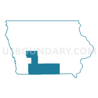
Outline

Summary
| Unique Area Identifier | 192933 |
| Name | South Central Iowa PUMA |
| State | Iowa |
| Area (square miles) | 6,408.91 |
| Land Area (square miles) | 6,367.42 |
| Water Area (square miles) | 41.49 |
| % of Land Area | 99.35 |
| % of Water Area | 0.65 |
| Latitude of the Internal Point | 41.05181030 |
| Longtitude of the Internal Point | -93.97098940 |
Maps

Graphs
Select a template below for downloading or customizing gragh for South Central Iowa PUMA, Iowa


Neighbors
Neighoring Public Use Microdata Area (by Name) Neighboring Public Use Microdata Area on the Map
- Northeast Missouri PUMA, MO
- Northwest Central Iowa--Storm Lake, Denison & Cherokee Region PUMA, IA
- Northwest Missouri PUMA, MO
- Southwest Iowa--Council Bluffs City PUMA, IA
- Wapello, Mahaska, Washington, Jefferson, Keokuk, Davis & Van Buren Counties PUMA, IA
- Warren, Jasper, Marion, Dallas (West) & Madison Counties PUMA, IA
Top 10 Neighboring County (by Population) Neighboring County on the Map
- Dallas County, IA (66,135)
- Warren County, IA (46,225)
- Wapello County, IA (35,625)
- Marion County, IA (33,309)
- Nodaway County, MO (23,370)
- Mahaska County, IA (22,381)
- Carroll County, IA (20,816)
- Crawford County, IA (17,096)
- Page County, IA (15,932)
- Madison County, IA (15,679)
Top 10 Neighboring County Subdivision (by Population) Neighboring County Subdivision on the Map
- Creston city, Union County, IA (7,834)
- Centerville city, Appanoose County, IA (5,528)
- Osceola city, Clarke County, IA (4,929)
- Troy township, Monroe County, IA (4,445)
- Chariton city, Lucas County, IA (4,321)
- Leroy township, Audubon County, IA (2,496)
- Cass township, Guthrie County, IA (2,410)
- Lamoni city, Decatur County, IA (2,324)
- Union township, Dallas County, IA (2,134)
- Union township, Putnam County, MO (2,116)
Top 10 Neighboring Place (by Population) Neighboring Place on the Map
- Creston city, IA (7,834)
- Centerville city, IA (5,528)
- Osceola city, IA (4,929)
- Chariton city, IA (4,321)
- Albia city, IA (3,766)
- Lamoni city, IA (2,324)
- Audubon city, IA (2,176)
- Greenfield city, IA (1,982)
- Leon city, IA (1,977)
- Mount Ayr city, IA (1,691)
Top 10 Neighboring Unified School District (by Population) Neighboring Unified School District on the Map
- Carroll Community School District, IA (14,441)
- Knoxville Community School District, IA (11,461)
- Creston Community School District, IA (9,722)
- Perry Community School District, IA (9,469)
- Winterset Community School District, IA (9,444)
- Centerville Community School District, IA (9,212)
- Atlantic Community School District, IA (8,807)
- Harlan Community School District, IA (8,688)
- Davis County Community School District, IA (8,512)
- Clarke Community School District, IA (7,993)
Top 10 Neighboring State Legislative District Lower Chamber (by Population) Neighboring State Legislative District Lower Chamber on the Map
- State House District 47, IA (54,425)
- State House District 3, MO (35,529)
- State House District 4, MO (35,512)
- State House District 2, MO (35,389)
- State House District 1, MO (33,818)
- State House District 73, IA (32,505)
- State House District 95, IA (29,515)
- State House District 93, IA (29,303)
- State House District 72, IA (28,523)
- State House District 90, IA (28,496)
Top 10 Neighboring State Legislative District Upper Chamber (by Population) Neighboring State Legislative District Upper Chamber on the Map
- State Senate District 12, MO (169,332)
- State Senate District 18, MO (159,547)
- State Senate District 24, IA (83,683)
- State Senate District 37, IA (66,229)
- State Senate District 49, IA (60,560)
- State Senate District 45, IA (60,365)
- State Senate District 36, IA (59,364)
- State Senate District 47, IA (57,346)
- State Senate District 48, IA (56,494)
- State Senate District 26, IA (55,929)
Top 10 Neighboring 111th Congressional District (by Population) Neighboring 111th Congressional District on the Map
- Congressional District 6, MO (693,974)
- Congressional District 3, IA (642,116)
- Congressional District 2, IA (620,856)
- Congressional District 4, IA (609,487)
- Congressional District 5, IA (577,453)
Top 10 Neighboring Census Tract (by Population) Neighboring Census Tract on the Map
- Census Tract 601, Madison County, IA (6,433)
- Census Tract 9601, Clarke County, IA (4,971)
- Census Tract 211, Warren County, IA (4,795)
- Census Tract 802, Davis County, IA (4,752)
- Census Tract 9503, Guthrie County, IA (4,363)
- Census Tract 9501, Guthrie County, IA (4,296)
- Census Tract 1902, Union County, IA (4,241)
- Census Tract 603, Madison County, IA (3,982)
- Census Tract 1904, Union County, IA (3,881)
- Census Tract 9602, Decatur County, IA (3,826)
Top 10 Neighboring 5-Digit ZIP Code Tabulation Area (by Population) Neighboring 5-Digit ZIP Code Tabulation Area on the Map
- 52501, IA (30,220)
- 52577, IA (15,055)
- 50801, IA (9,590)
- 50022, IA (8,494)
- 50273, IA (8,251)
- 52544, IA (7,847)
- 51632, IA (7,297)
- 52537, IA (7,098)
- 50213, IA (6,812)
- 50049, IA (6,493)